


John Delano, University at Albany, State University of New York
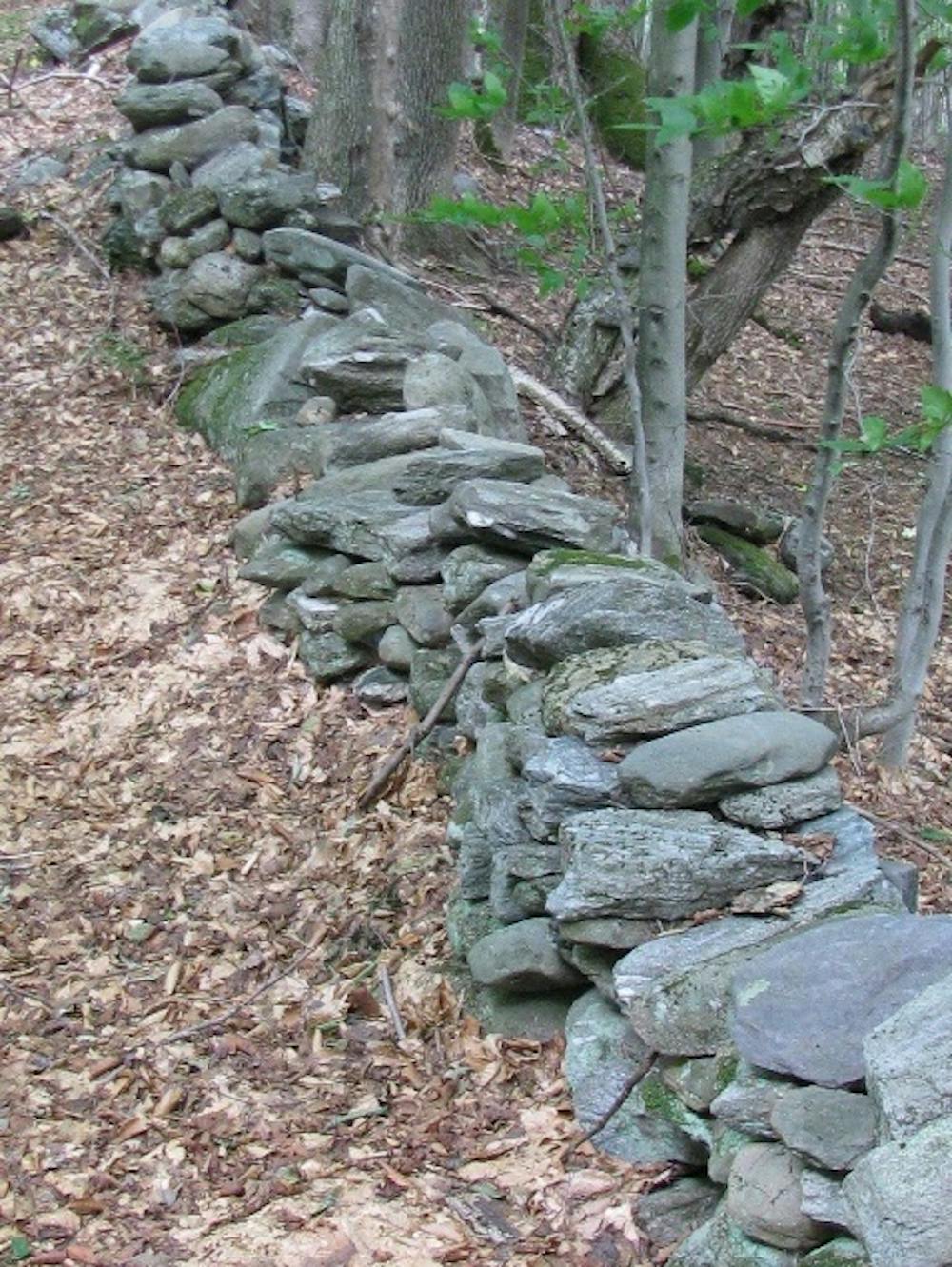
When I was a kid living in southern New Hampshire, my family home was on the site of an abandoned farmstead consisting of massive stone foundations of quarried granite where dwellings once stood. Stone walls snaked throughout the forest. As I explored the deep woods of tall oaks and maples, I wondered about who had built these walls, and why. What stories did these walls contain?
John Delano, CC BY-ND
Decades later, while living in a rural setting in upstate New York and approaching retirement as a geologist, my long dormant interest was rekindled by treks through the neighboring woods. By now I knew that stone walls in New England and New York are iconic vestiges from a time when farmers, in order to plant crops and graze livestock, needed to clear the land of stones. Tons and tons of granite had been deposited throughout the region during the last glaciation that ended about 10,000 years ago.
By the late 1800s, nearly 170,000 subsistence farming families had built an estimated 246,000 miles of stone walls across the Northeast. But by then, the Industrial Revolution had already started to contribute to the widespread abandonment of these farms in the northeastern United States. They were overgrown by forests within a few decades.
During my more recent walks through the woods, on a whim I used a hand-held GPS unit to map several miles of stone walls. And that was how I realized that in addition to being part of an American legacy, their locations record a centuries-long history of the Earth’s wandering magnetic field.
Connecting the walls with historical maps
The complex array of walls that emerged from my GPS readings made no sense to me until I found an old map of my town’s property boundaries at the local historical society. Suddenly I saw that some of the stone walls on my map lay along property lines from 1790. They marked boundaries.
My subsequent searches of church records and decades of the federal census revealed the names of these farm families and details of their lives, including annual yields from their harvests. I started to feel like the stone walls were letting me connect with the long-gone folks who had worked this land.
Now the wheels in my scientist’s mind really started spinning. Did the original land surveys from the 18th and 19th centuries in this part of town still exist? What were the magnetic compass-bearings of those boundaries on the original surveys?
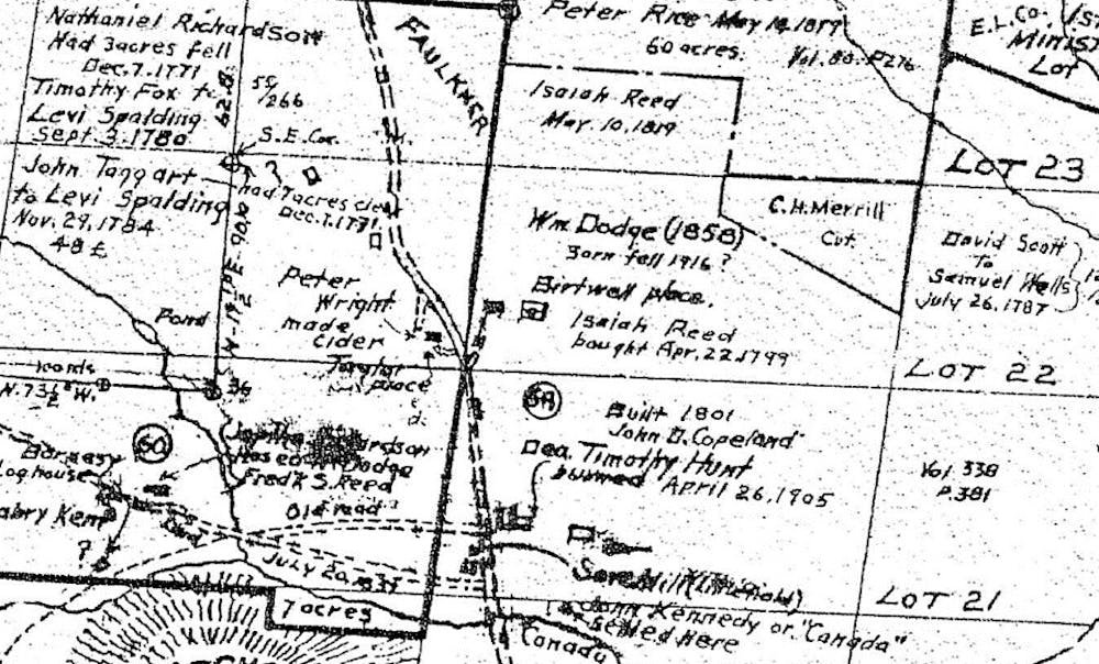
Charles Peirce/Stoddard, New Hampshire
I knew that the location of magnetic north drifts over time due to changes in the Earth’s core. Could I determine its drift using stone walls and the old land surveys? My preliminary map of stone walls and a few historical surveys showed that the approach had potential.
To have any scientific value, though, this work had to encompass much larger areas. I needed a different strategy for finding and mapping stone walls. Luckily I found two troves of useful information. First, the New York State Archives had hundreds of the original land surveys from the 18th and 19th centuries. And secondly, airborne LiDAR (light detection and ranging) images were publicly available that could reveal stone walls hidden beneath the forest canopy over much larger areas than I could cover on my own by foot.
Siberian Art/Shutterstock.com
Tracking magnetic north’s drift over time
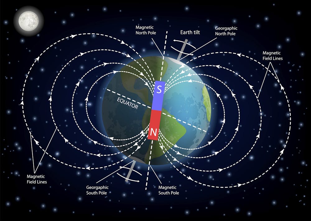
The Earth rotates on its axis once every 24 hours. The location of that spin axis in the Northern Hemisphere is called true north, and wanders very slowly. The location of true north can be considered stationary, though, on a timescale of a few centuries.
But that’s not where a compass aims when it points north. The location of the north magnetic pole is not only at a different location from true north, but also changes rapidly – currently about one degree per 10 years in New England.
The difference in direction between true north and magnetic north (at a specific time and location on the Earth) is known as the magnetic declination. Global information about historic variations in magnetic declination is currently based on thousands of magnetic compass-bearings recorded in ships’ navigational logs from 1590 onwards.
But now my work on 726 miles of stone walls provides an independent check on magnetic declination between 1685 and 1910.
Here’s the logic. When settlers were piling up those stones along the boundaries of their plots, they were using property lines that had been laid out according to the surveyors’ compass readings. Using LiDAR images, the bearings of those stone walls could be determined with respect to true north and compared with the surveyors’ magnetic bearings. The difference is the magnetic declination at the time of the original survey.
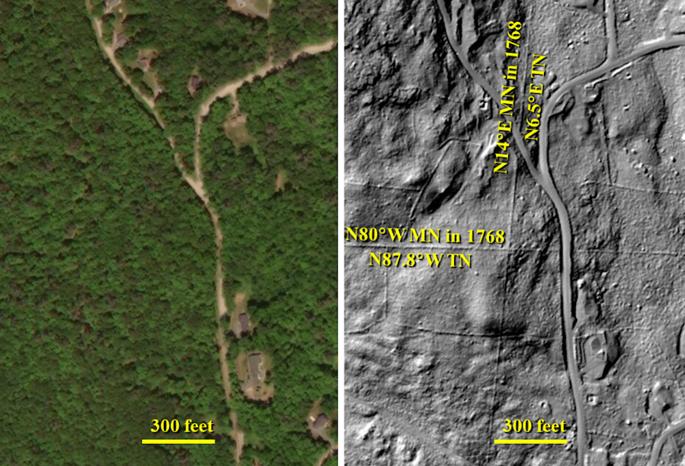
For example, the original surveys divided New Hampshire’s Stoddard township into hundreds of lots with boundaries with magnetic compass-bearings of N80 degrees W and N14 degrees E in 1768. As the land was cleared for farming, owners built stone walls along and within those 1768 surveyed boundaries.
CC BY-ND
Now one can compare the bearings of those stone wall-defined boundaries relative to magnetic north and true north today. The difference shows that the magnetic declination at this location in 1768 was 7.6 ± 0.3 degrees W. That’s a good match for scientists’ current geophysical model. Since the magnetic declination at this location today is 14.2 degrees W, the direction to magnetic north at this location has moved about 6.6 degrees further west since 1768.
Data from these stone walls strengthen the current geophysical model about the Earth’s magnetic field.![]()
John Delano, Distinguished Teaching Professor of Atmospheric and Environmental Sciences, University at Albany, State University of New York
This article is republished from The Conversation under a Creative Commons license. Read the original article.


